The Sheffield Supertram has three routes, Blue, Yellow, and Purple, and the Tram-Train.
The Yellow Route terminates at Middlewood and
Meadowhall Interchange, and the Blue Route at
Malin Bridge and Halfway. The Purple and Tram-Train services
both start in the city centre at Cathedral, with the Purple
ending at Herdings Park, and the Tram-Train going onto
National Rail to make it to Rotherham Central.
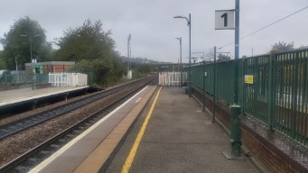
Middlewood
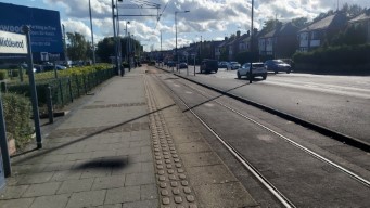
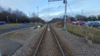
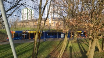
Middlewood is the northern terminus of the Yellow Line, out past Hillsborough. It has a single
line for trams to park next to the roadway, with space for two trams to sit in line.
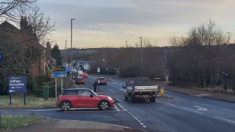
The tram line runs along Middlewood Road A6102, but deviates off it for terminating trams.
This terminating point is before, but a short walk from, the town of Middlewood, which is more
or less the edge of the built-up Sheffield area, although linear settlement continues along
the A6102.
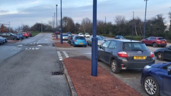
If you're on board a Yellow Route tram, the stop will be referred to as Middlewood Park & Ride,
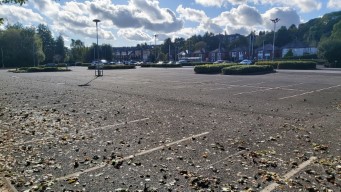
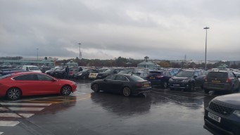
and Middlewood does not disappoint – a reasonably large car park awaits you, with free parking.
There seems to be no rule that you have to use it a park-and-ride, I suppose you could walk
into Hillsborough or Middlewood.
I visited it around 12pm on a clear, sunny Sunday in October.
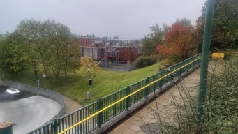
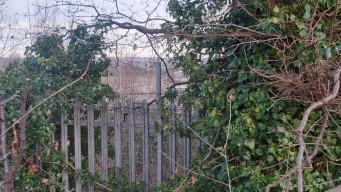
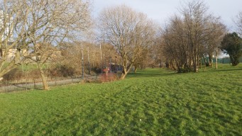
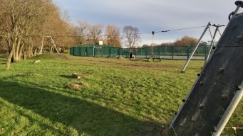
The car park in its entirity. Behind the fence at the back is Sheffield
Wednesday's training ground, not in use when I peeked over it.
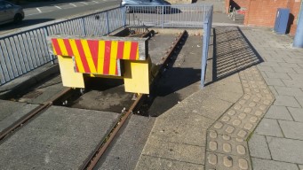
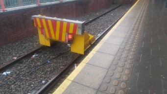
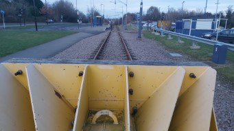
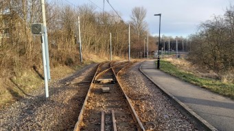
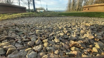
This looks like it'll stop a tram. The buffer stop from the rear, accidentally taken in portrait mode.
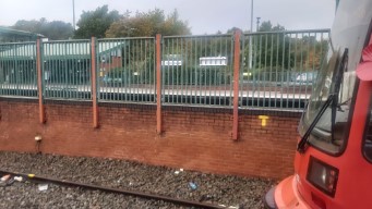
Interesting to see the rails not buried in Tarmac.
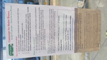
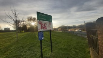
This flyer is accurate to what's going on – bus services are being cut,
and tram fares are increasing. The response of the authorities seems to be blame-shifting: from
the City Counil to the South Yorkshire Combined Authority, to Westminster.
This guy kinda scares me.
This isn't a low shot for artistic effect, moreso that SYMCA is allergic to putting
some half-decent seating at their bus and tram stops.
Overall, Middlewood seems to do its job as a small park-and-ride well, people were using it as such,
even on a quiet Sunday lunchtime. It seems a logical place to end the line, with room to constructed
the siding necessary, although there isn't much to do up there but wait for the tram back – most
people have got off already. It does serve some nearby low-rise council blocks,
as well as more suburban residential developments across the road.
Meadowhall Interchange
Meadowhall Interchange is the north-eastern terminus of the Yellow Route. It serves the
large Meadowhall shopping centre, as well as interchange with Meadowhall bus station and
railway station.
Meadowhall (or Meadowhell, if you're so inclined) is a large shopping centre, a combined-arms sensory assault,
and a horrifying, dystopian vision of the future. Built in 1990 on the sight of a former steelworks,
as a scheme to murder Sheffield and Rotherham city centres, it houses basically every high-street shop
you could want, as well as an extensive food court. It has excellent public transport connections.
I visited around 1pm on a fairly dismal Saturday in late October.
The bus station is well served by buses to Sheffield and Rotherham.The train station sits on a junction of the lines between Sheffield, Rotherham, Doncaster, and Barnsley; all of South Yorkshire's districts.
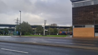
Meadowhall is built in the Don Valley, which was once one of the busiest industrial areas in the world.
The valley provided an ideal transport corridor in hilly South Yorkshire - the river itself is navigable,
and it features two railway lines. That not being enough, the powers that be decided
the M1 needed to run through it. This necessitated elevating the motorway, but even an ordinary viaduct would
take up too much space, so they had to get creative.
This double-decker monstrosity is amongst my favourite pieces of infrastructure, and you get a lovely view of it
from the IKEA restaraunt. Also pictured is a tram (at Tinsley/Meadowhall South), and one of those signs.
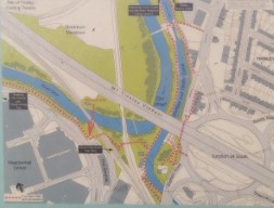
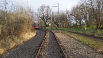
This map is attached to one of those info-boards, and it gives you some idea to the insanity. The tram route
splits in a Y-junction - the left fork curves round Meadowhall and approaches Meadowhall Interchange from the north,
which always serves to disorient me. With the right fork, the tram tracks merge with the mainline railway, as this
is the route the Tram-Trains take to Rotherham.
The map.
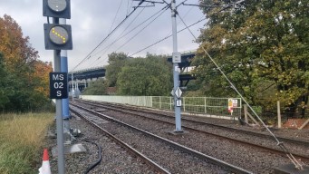
The viaduct twists and turns with the river, the railway, and the tramway.
Off to the right, you can see where the tram-trains branch off. The railway
branches off further back.
As the bloody great motorway might suggest, Meadowhall is quite a car-dependant place. The roads are wide
and straight, and the traffic lights treat pedestrians as an afterthought. This is fine, if you're sensible and
follow marked routes, arriving and leaving at Meadowhall Interchange. I am not sensible. Most of the time, a trip
to Meadowhall is timed by how long I can last before the general atmosphere forces me out for fresh air. Once that
happens, the urge that I can "find a shortcut" tends to overwhelm me.
This is the route I elected to take out of Meadowhall. In the rain.
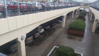
This two-story car park construction wraps around most of Meadowhall. In the background,
note the three-lane road thing that you just sort of have to wander across.
I've mostly written about Meadowhall and the Don Valley - there isn't much to see at the tram stop
itself. It's a single island platform, with two tracks for trams to terminate. There isn't quite
cross-platform interchange with the trains, although it's a very short walk through a little waiting
area with ticket and snack vending machines. A set of stairs, or a long ramp, connects to an upper level
with a train ticket office, and a covered bridge connecting to the TSY building, which has a ticket office
for buses and trams, and a further bridge taking you across the road and the Don into the shopping centre.
Close enough to cross-platform interchange.Obligatory buffer shot. These don't feel so heavy-duty for some reason.
I have perhaps been a smidgen less than neutral in my portrayal of Meadowhall, but it is useful,
in the sense that it concentrates lots of shops in one place. The area may be built for the car,
but the inside of Meadowhall is of course pedestrianised - in fact Meadowhall is so large it gives
its corridors street names, and the interior is mapped on Google Maps. Of course, Meadowhall is private
property - you won't find street homelessness here. This is why I call it a dystopian vision of the future.
Or, you know, it could just be a shopping centre.
The Meadowhaul.Bonus image: I love substations.
Malin Bridge
Coming Soon.
Halfway
Halfway Park & Ride is the southwestern terminus of the Blue Line, in the area of Halfway. It sits on
B6053 Eckington Road. I visited on the same day I visited Herdings Park, at about 15:45.
Perhaps the only interesting thing about Halfway Park & Ride is it's name – nobody knows its source.
A popular folk etymology is that its "Halfway to London", as it's 10 kilometres as the crow flies
from Sheffield Cathedral, about an hour on the tram from Malin Bridge. Out here, you are clearly
leaving the city, with farmer's fields and low-rise housing forming our backdrop.
Halfway tram stops serves three places; the P&R, the Halfway estate, and the post-industrial waste.
I didn't take the time to explore Halfway Estate, but Wikipedia tells me it was an interesting
expirement in social housing – designed with green space, district heat, and a layout such that no
two houses face each other.
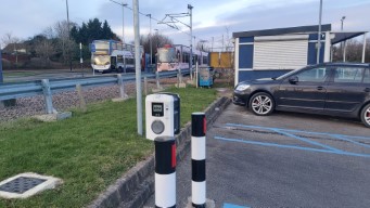
As for the tram stop itself, it's paired with some electric car chargers, as well as a small
lay-by where the 120 bus turns around.
Big electric vehicle, small electric vehicle, double-decker bus.
It's all here – the bus layby, the car park, and an hour of holding tight, please.
Halfway has a moderately sized park and ride attached. Like the one at Middlewood, it is unstaffed
and free-to-park, with you then paying the normal fare for the tram into town. I expect the idea of it
is to attract traffic from the nearby M1 Junction 30, since much of the surrounding area is rural. It
was reasonably well-used, although the tram stop was not busy at all while I was there. The tram stop
is at the roundabout where Eckington Road meets Station Road, although forty years too late to offer
interchange with the long-closed Killamarsh West station. This railway line is now the "back way" into
Sheffield, only used for freight and diversions (one of which I am lucky enough to have been on).
The wait wasn't that long – about 15 minutes – but there's not a lot to do. I enjoyed a packet of crisps,
while one of my fellow passengers played on the tracks.
High density, pedestrian-friendly, human-scale transit-oriented development.
Higher density, pedestrian-friendlier, more human-scale more-transit-oriented developmentier.
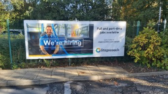
Halfway tram stop is also the terminus for some of the 120 buses – those operated by Stagecoach. Having ridden trams all
afternoon, I made perhaps the foolish decision to ride the bus back into town. It follows a similar route
to the Blue Route; one must imagine that whatever version of the 120 existed before the Supertram got very busy.
However, since taking it now is a stupid decision, it was very quiet. As was the bus; our hybrid model caught me
by suprise as it silently pulled out of the lay-by. I did enjoy the views from the top deck, but it took a little while.
I was the only person on this bus for some time – taxi experience for £1.
Cathedral
Coming when I need something from town.
Update: coming when I need something from town and remember this is a terminus.
Herdings Park
Herdings Park is the terminus of the Purple Route. It's situated in south-west Sheffield, in
Herdings Park (yes, in).
I visited in a cold sunny winter's Friday, at about 14:45.
The Purple Route is the least frequent of Sheffield's tram routes, running once an hour! on
weekdays and Saturdays, and twice an hour on a Sunday. It starts at Cathedral, and parallels
the Blue Route as far as White Lane, where it continues a short while along A6102 Norton Road,
before branching off onto a single-track alignment, where it runs along the boundary of
Herdings Park on dedicated ballasted track.
The combination of the very low frequency, and the track running in the park creates a strange
situation where walking on and around the tracks feels very safe. Luckily, walking on track
ballast is very uncomfortable.
Single Tracking.
Herdings Park is a park. Not pictured is the constant road noise, which kept me
oriented when I walked back through Herdings.
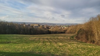
One of my favourite things about Sheffield is how you will get suprised by views when
you least expect it. You can see the whole city from this bus stop, and my phone camera
doesn't do it justice, especially with weather like this, it was incredible. The large grey
building centre-frame is the Royal Hallamshire Hospital, for orientation.
In the second picture, you can see the buses which supplement the infrequent trams for people heading
into the city. It's a very scenic bus stop, and I could have pulled off the artsy shot a lot
better if I wanted to embed rocks and triangular steel into my stomach. This was taken from
behind the buffer stop – no Lottas were put in harm's way.
Still Sheffield.
You'd better believe your arse I had a go. One of the better park zipwires I've used.
The sick and twisted vision the urbanists have for Britain.
The Purple Route – why so infrequent? I don't know, I'm not Stagecoach,
nor Travel South Yorkshire. It seems like there's only one tram that runs the route, and
presumably, two on Sundays. There is more stock available on a Sunday, since other routes run
less frequently, but equally, every time I've gone past the depot, they've had trams in bed.
Perhaps it's lack of drivers which prevents them running more frequent
service. Either way, it feels like a big waste, to spend all that money on tram infrastructure to
run a service less intensive than the busses. I suppose the Purple does provide extra capacity
on most of the Blue Route, however, the tram-tree-tunnel into a park is too lovely not to use more.
Overall, Herdings Park is a nice little park with an unusual but lovely tramway, although it's
not especially tranquil, due to the main road. The stop also could serve the residents of Herdings,
which is reasonably dense council development. It could, however, really do with more frequency.